This is a one-way walk through Dorćol, Belgrade’s old quarter between the Old Town and the Danube. It starts at Cookie Beacon Kralja Petra, our brunch spot in Stari Grad, and ends at Marina Dorćol on the river. It has eight stops and about 2.5 km of straight-line legs, so the walked distance is longer. It is mostly downhill: the river end sits roughly 48 m lower than the start, with two short rises on the way. Every stop tells you the way back up, in case you want to stop early. Two days change the plan: the Ethnographic Museum closes on Wednesdays, and on Fridays the mosque holds its main weekly prayer.
The name comes from Turkish dört yol, “four roads”, meaning a crossroads (Wikipedia). This route takes the things to do in Dorćol in order, from the Old Town down to the water: a university, a stock exchange, two Ottoman-era buildings, a fountain where a fight changed the city, and the river.
Dorćol, Belgrade: route and map at a glance
| # | Stop | From the previous stop (straight-line) | Look for |
|---|---|---|---|
| 0 | Start: Kralja Petra street, Stari Grad | — | — |
| 1 | Captain Miša’s Mansion, Studentski trg | 236 m | The Cyrillic dedication over the central bay |
| 2 | Ethnographic Museum, Studentski trg 13 | 187 m | A museum in a stock-exchange building |
| 3 | Sheikh Mustafa’s türbe, Višnjićeva 1 | 154 m | The stone panel above the small door |
| 4 | Bajrakli Mosque, Gospodar Jevremova 11 | 221 m | One slim minaret above the roofs |
| 5 | ”The Clock” mural, Mihailo Petrović Alas school | 134 m | A notebook page with a digital clock in it |
| 6 | Čukur fountain, Dobračina street | 374 m | The date carved under the boy |
| 7 | Dorćol Platz, Dobračina 59b | 581 m | What is on today |
| 8 | Marina Dorćol, on the Danube | 641 m | The river, at last |
All distances are straight-line metres between map points (OpenStreetMap), so real walking distances are longer. For walking time, open the route in Google Maps in two parts, because phone browsers take only three stops per link: start to stop 4 and stop 4 to the river. Heights come from the EU-DEM elevation model and are approximate.
Base camp: Kralja Petra
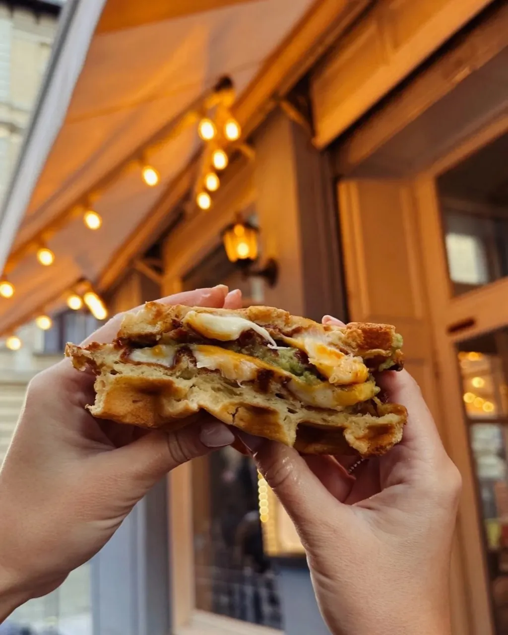
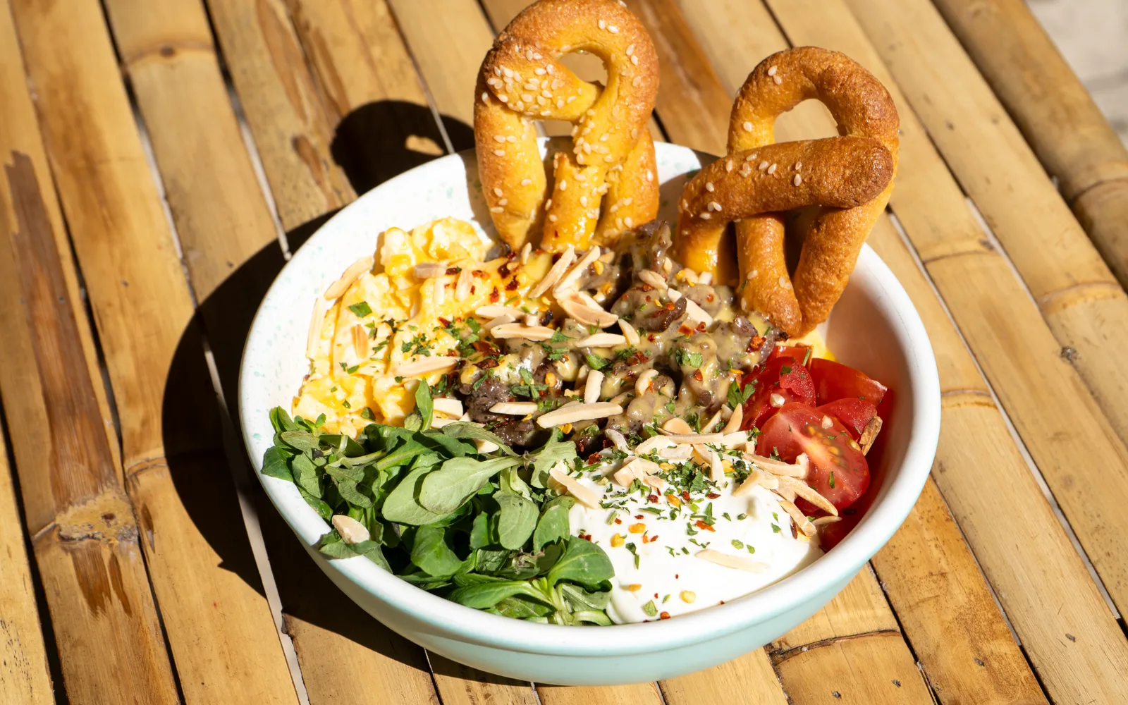
“Base camp” is where an expedition sets out from. Ours is the brunch spot on Kralja Petra, open daily 09:00 to 18:00. Gravity does most of the work on this walk, but eat first anyway. The Breakfast Crunch Pretzelbun-Sandwich (egg, cheddar, crispy bacon and spicy jalapeño on a homemade pretzel bun) holds you for a few hours. The Eggs Benedict on Cheddar-Scones is the other good choice. For the road, an Orange Espresso Tonic, or a V60 if you want your coffee black and slow. Every dish and drink for this spot is on the Kralja Petra menu.
The first stop is on Studentski trg (Students’ Square), a short walk east. Follow the first Google Maps link above.
1. Captain Miša’s Mansion on Studentski trg
The red-and-cream palace on the square was finished in 1863 for Miša Anastasijević, a wealthy trader known as Captain Miša. Czech architect Jan Nevole designed it. It was meant as a home for the court of Karađorđe’s grandson, who had married Miša’s youngest daughter. Once it was built, Miša gave the whole building to the country “for educational purposes”, and the Belgrade Higher School moved in that September (Wikipedia). Today it is the seat of the University of Belgrade.
Look for: the line of Cyrillic letters over the central windows, in the old spelling with a hard sign (Ъ) after СВОМ. It means “Miša Anastasijević, to his fatherland”.
Way back up: 236 m straight-line to the start, almost level.

Photo: Radosław Botev, CC BY 3.0 pl, cropped, via Wikimedia Commons
2. The Ethnographic Museum
Walk along the square to number 13. This is the first of the two short rises: a few metres up, by the elevation model. The building went up in 1933–34 for the Belgrade Stock Exchange, to a design by Aleksandar Đorđević. The museum, founded in 1901, moved in only in 1951 (Wikipedia). Its collections hold about 200,000 items, among them costumes, jewellery and furniture.
The official site lists it as closed on Wednesdays and open 10:00 to 20:00 on every other day (etnografskimuzej.rs, checked on 21 October 2026).
Look for: before you read the sign, decide if the front looks like a museum or a stock exchange to you. Then go in, or keep walking.
Way back up: 120 m straight-line, slightly downhill to the start. This is the highest point of the walk. From here, the streets mostly run down.
3. Sheikh Mustafa’s türbe
A türbe is a tomb. This small stone one, at the top of Višnjićeva street (no. 1), by Studentski park, holds the grave of Sheikh Mustafa, head of a dervish lodge (a tekke) that once stood here. An inscription on it is dated 1783. The Europeana write-up adds that the writer and teacher Dositej Obradović died in that tekke in 1811. The building was restored in 2013 and is usually closed, apart from Museums Day in May (Europeana, checked on 21 October 2026).
Look for: the stone panel above the small door. See it from the pavement.
Way back up: 274 m straight-line to the start, about 9 m higher.

Photo: Mickey Mystique, CC BY-SA 3.0, cropped, via Wikimedia Commons
4. Bajrakli Mosque
The Bajrakli Mosque on Gospodar Jevremova is Belgrade’s only surviving mosque (RFE/RL). It is Ottoman-era. Sources give different building dates, so we do not pick one. Bajrak means flag. The usual explanation is that a flag raised here once told the city’s other mosques when it was time to pray (Danas).
It is a working mosque. Prayers are held five times a day, with the main congregational prayer on Friday (Danas, linked above). If the door is open and you go in, dress modestly and take your shoes off at the entrance. Do not visit during prayers. If the door is closed, the street is the visit.
Look for: the one slim minaret above the roofs, and the fountain in front, where worshippers wash before prayer.
Way back up: 349 m straight-line, about 16 m higher.

Photo: Fred Romero, CC BY 2.0, cropped, via Wikimedia Commons
5. “The Clock” on the Mihailo Petrović Alas school
The Mihailo Petrović Alas primary school stands at Gospodar Jovanova 22 (not the same street as Gospodar Jevremova, the mosque’s street, one block over). In 2011, the story goes, artists and the school’s pupils painted a mural on its wall: a page from a school notebook with a working digital clock set inside it. The clock has about 20,000 LEDs (Spotted by Locals). Walk around the building’s street sides to find it.
Look for: is it still keeping time? Check it against your phone.
Way back up: 392 m straight-line, about 21 m higher. This is the lowest point so far.
Side quest: Dositej’s Lyceum
A “side quest” is a detour you can skip. Just 56 m (straight-line) from the school, at Gospodar Jevremova 21, is the Museum of Vuk and Dositej. It is in a house from 1739, one of the eight oldest houses left in Belgrade. The Higher School that Dositej Obradović, the man from the tekke at stop 3, founded in 1808 held its classes here. Vuk Karadžić, who reformed the Serbian alphabet, was one of its first students (Wikipedia). That school later grew into the University of Belgrade, whose seat you saw at stop 1.
Official hours: Tuesday, Wednesday, Friday and Sunday 10:00 to 18:00; Thursday and Saturday 12:00 to 20:00; closed on Mondays (narodnimuzej.rs, checked on 21 October 2026).
6. Čukur fountain
On Dobračina street stands a small fountain with a bronze boy lying on top. In June 1862, a quarrel at this fountain ended with the death of a boy, Savo Petković. Serbian and Ottoman police fired at each other, and a riot followed. On the third day, cannons in the fortress shelled the town. About 50 people were killed (Wikipedia). In the following year more than 8,000 Muslims left the city, and in April 1867 the last Ottoman garrison handed over the fortress (Wikipedia). The sculpture, The Boy With a Broken Pitcher by Simeon Roksandić, was put up in 1931.
This leg holds the second short rise, a few metres by the elevation model.
Look for: the date carved into the marble under the boy: 26 May 1862. Wikipedia says every source gives 15 June 1862 for the event, and that it is not known why the monument says 26 May.
Way back up: 592 m straight-line, about 16 m higher.

Photo: Андрей Романенко, CC BY-SA 4.0, cropped, via Wikimedia Commons
7. Dorćol Platz
Follow Dobračina downhill. Somewhere on this leg you cross Cara Dušana street, the old line between Upper and Lower Dorćol. Lower Dorćol, by the river, was often flooded before the city built it up, and it was long home to a large Jewish community (Wikipedia).
At Dobračina 59b is Dorćol Platz. It has been open since 2016 on the site of a former industrial complex, with two indoor spaces and a seasonal garden (dorcolplatz.rs, checked on 21 October 2026). It is an events venue, so it has no fixed visiting hours.
Look for: what is on today. The official site lists no programme, but it gives an events phone number and email.
Way back up: 1,049 m straight-line, about 44 m higher. This is the point to decide: take the bus or walk back up.
8. Marina Dorćol and the Danube
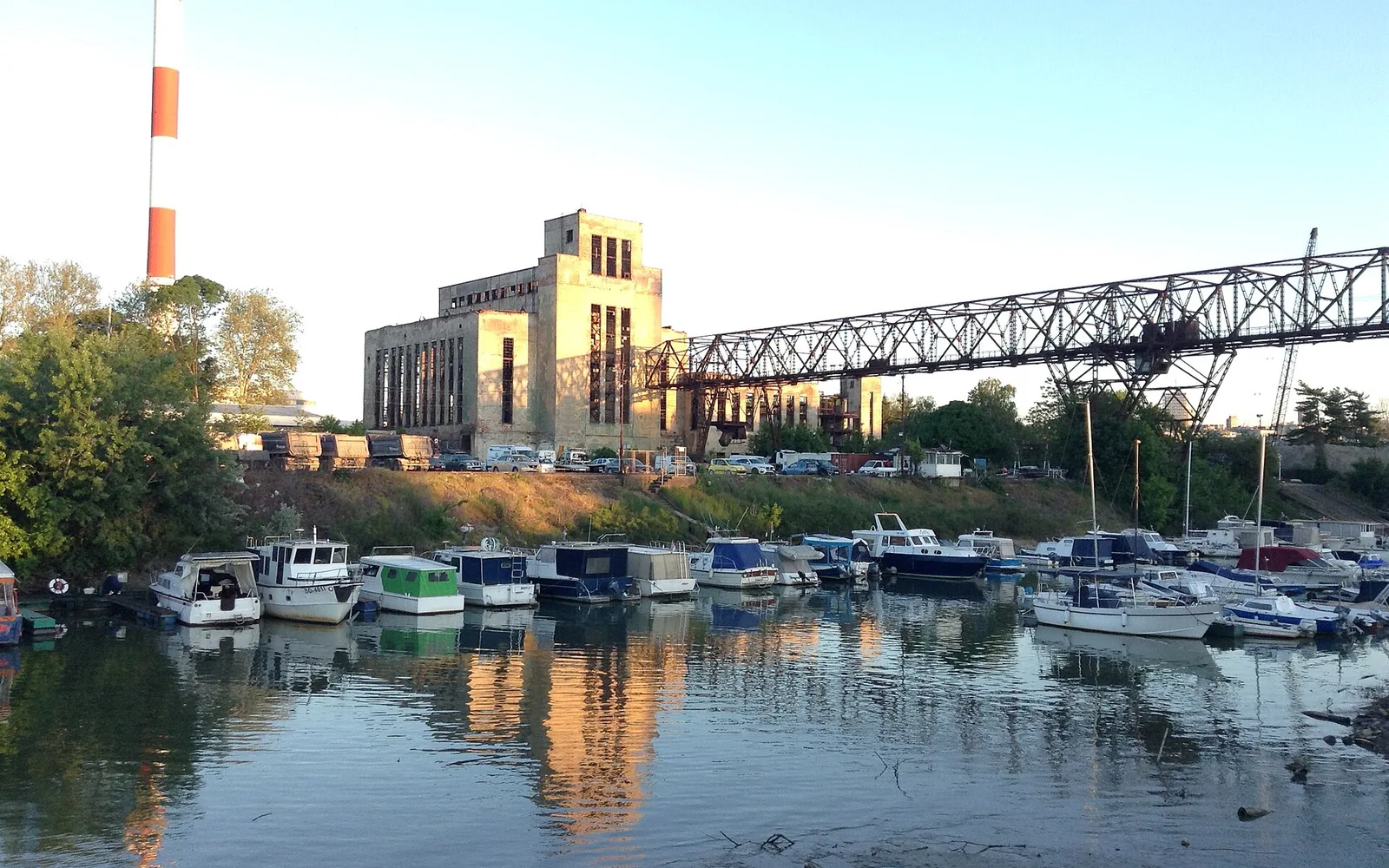
The last leg runs down to the water. Marina Dorćol sits on the right bank of the Danube, with small boats along the jetties and the old industrial buildings behind them. Here you are roughly 48 m lower than Kralja Petra. That is the “downhill” in the title.
Look for: the river itself. You started on a ridge between two rivers, and this is the bigger one.
Way back up: 1,389 m straight-line to the start.
The fork: which day works
“The fork” is where you choose. Two cases change this walk:
- Wednesday: the Ethnographic Museum is closed. Do the outside and the side quest instead.
- Friday around midday: the main weekly prayer is at the Bajrakli Mosque. See it from the street and keep going.
Return to base camp
The bus is the easy way back. Walking back up is about 1.4 km straight-line and roughly 48 m of climbing. Either way, a Pistachio Cream & Crumbs cookie or a Lemon-Pie cookie is the reward at Cookie Beacon in Stari Grad.
Practical box
| Item | Detail |
|---|---|
| Checked on | 21 October 2026 |
| Start | Kralja Petra 20a, Stari Grad. Open daily 09:00 to 18:00 |
| End | Marina Dorćol, on the Danube |
| Length | About 2.5 km of straight-line legs, one-way. Google Maps for walking time: part 1, part 2 |
| Slope | Mostly downhill, about 48 m net drop (EU-DEM model). Two short rises: stop 1 to 2, and stop 5 to 6 |
| Ethnographic Museum | Closed Wednesday. Other days 10:00 to 20:00. Tickets on etnografskimuzej.rs |
| Museum of Vuk and Dositej | Closed Monday. Tue, Wed, Fri, Sun 10:00 to 18:00; Thu, Sat 12:00 to 20:00. narodnimuzej.rs |
| Bajrakli Mosque | Working mosque. Five daily prayers, main prayer on Friday. Modest dress, shoes off inside |
| Sheikh Mustafa’s türbe | Usually closed. Outside view only |
| Dorćol Platz | Events venue, no fixed hours. Contact details on dorcolplatz.rs |
| Getting back | The city’s Secretariat for Public Transport states that line transport in Belgrade’s integrated fare system has been free since 1 January 2025 (bgprevoz.rs). Plan the bus in Google Maps |
Before and after Dorćol
For a shorter walk that stays on our own street, read Kralja Petra, house by house. And before you set off, check the menu for Kralja Petra.
Photo credits: hero image by Emilija Knezevic, CC BY 4.0, cropped, via Wikimedia Commons.